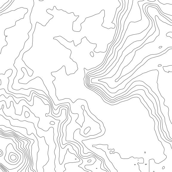
I couldn’t be prouder of this expedition. With a small team of dedicated guys and a single photograph from 1935, we managed to locate, reach, and photograph something almost no one has seen in the last hundred years: King Edward VIII Falls, on the upper Semang River in Guyana, and a truly hidden wonder.
The background
This expedition started as an idea for a fishing trip. While reading about the rivers, I ran across a mention of the Semang, a tributary of the massive Mazaruni that runs straight off the Pakaraima Escarpment — the same cliffs that form Guyana’s most famous natural landmark, Kaieteur Falls. Finding very little about the Semang online, I began to dig deeper, and eventually found a geographical survey report from 1935, tucked into the middle of The Geographical Journal, Vol. 88, No. 3 (September 1936), p. 262. The report, “New Fall on the Semang River in British Guiana,” described a waterfall over eight hundred feet tall, deep in the unexplored interior.
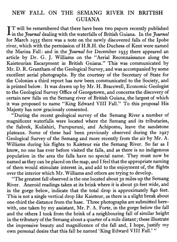
Its author was S. Bracewell, Economic Geologist for the Geological Survey Office in Georgetown. The photograph below was taken by his younger assistant, P. A. Forte, who later served as Acting Permanent Secretary for the Ministry of Communications and Works, and afterwards the Ministry of Works and Hydraulics, and chaired the Amerindian Lands Commission established in September 1967.
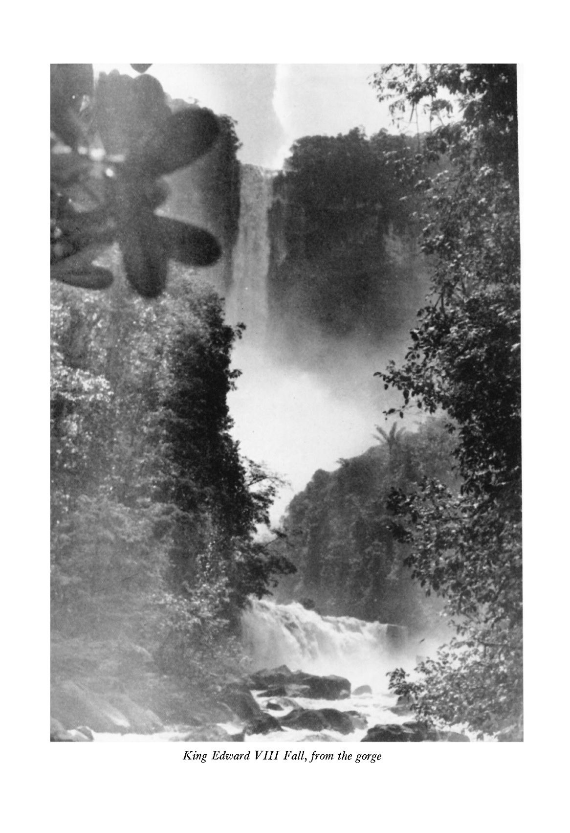
As an agent of the colonial government in British Guiana, Bracewell named the falls for King Edward VIII — now remembered mostly for abdicating the British throne to marry the twice-divorced American Wallis Simpson. In an ironic twist, the report was published in September 1936, less than three months before the king announced his abdication on 10 December.
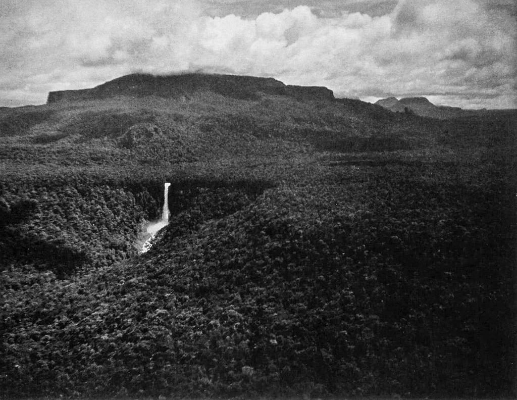
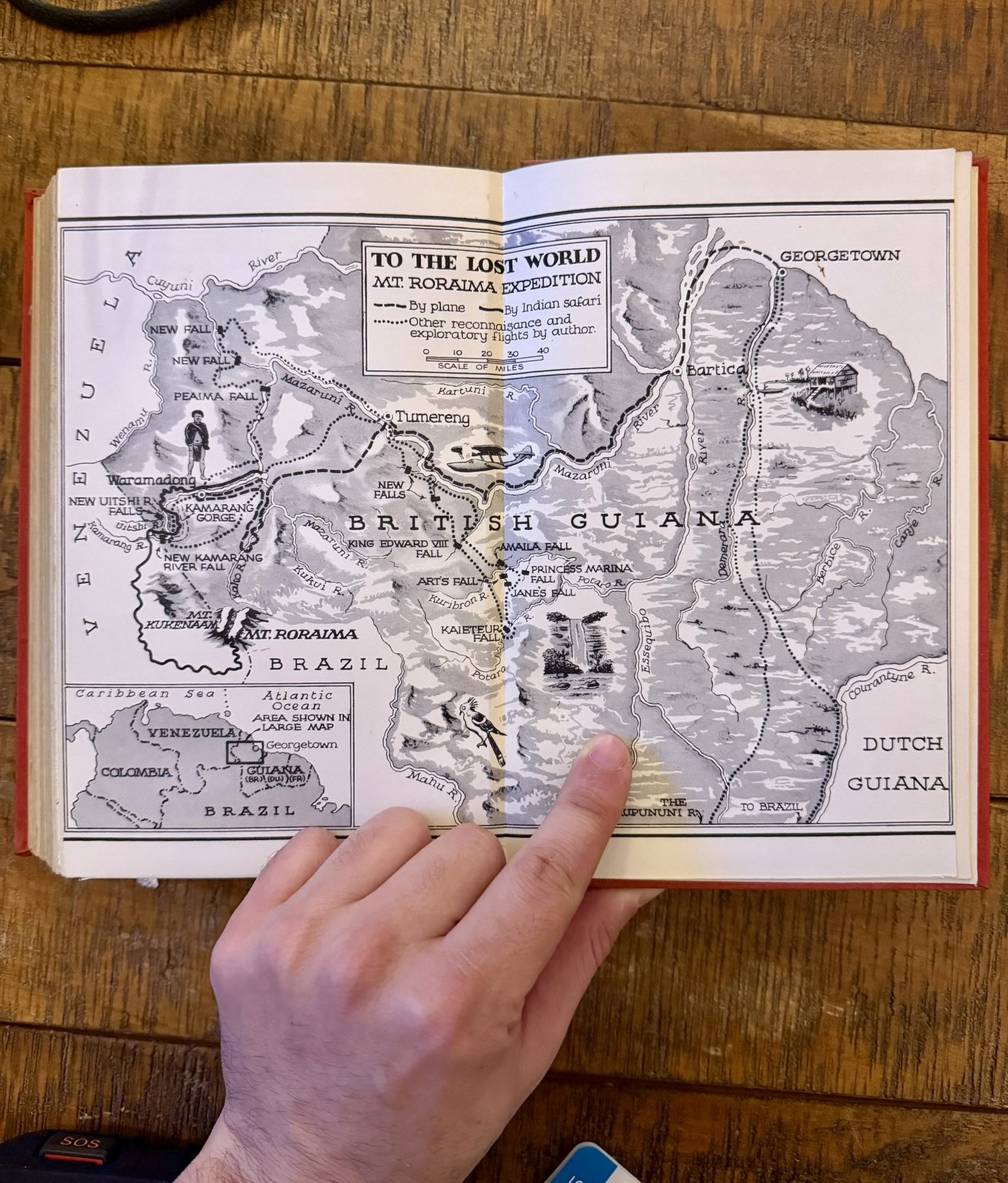
A few years later the falls turned up once more, in Paul A. Zahl’s To the Lost World (1939), an account of his expedition to Mount Roraima. Zahl included a long-distance aerial photograph, taken from Major Art Williams’s plane while flying west towards Tumereng, and a hand-drawn map.
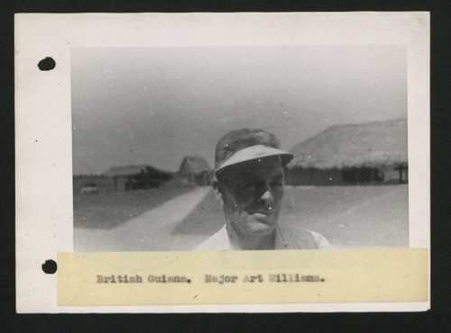
Williams also appears in the original 1935 report, as someone who had flown over the falls during the 1927 Geological Survey. As far as I can tell, he was the first Westerner ever to see them.
Since Zahl’s flyover there have been no reports, photographs, or published information about King Edward VIII Falls, and very little about the upper Semang at all. The area has stayed essentially unmapped and unexplored. Even as mining and logging moved into the lower Semang, as scientists surveyed the Guiana Shield, and as massive offshore oil reserves were found off the coast, this corner stayed untouched. In the twenty-first century that is remarkable: few places can claim to be seriously unexplored, with fewer than five confirmed visitors in a hundred years. And at a reported 840 feet, the falls may well be the tallest in Guyana — taller than Kaieteur, a tourist destination since the late 1800s. Somehow this waterfall, and the drainage it sits in, were simply overlooked.
The idea
After the archival research, Zahl’s book, and confirming over and over that the falls were truly off the map, I began to think about getting there myself. It was clear this would be no ordinary trip. There is no airstrip, no road, no trail, and almost no information — no trip reports, no guidebooks, not even anyone alive who had seen it.
Throughout the planning I tried to remember that I’m an interested American, and that something “unknown” to me might be well known to the people who live there. I’m not Guyanese, and I’m not part of any of the Indigenous nations — the Akawaio and Patamona among them — who have lived in the Pakaraima for millennia. But when Dillon Ross of Blackwater Adventures asked several local toshaos (elected chiefs) about the falls, none of them knew of it. That surprised me, and it deserves much deeper research with local people, both to understand what is known and to record any Indigenous name for the falls.
It was obvious we needed someone on the ground. I first talked with Philip Odwin, a Georgetown fisherman, who recommended Dillon as a logistics coordinator and guide. Once I’d explained the backstory to Dillon, it started to seem possible, and over several months we put together a plan to scout, locate, reach, and document the falls.
The expedition
We took an all-water route: a RiverQuest jet boat from Parika past Issano to Semang Landing, then our two aluminium launches upriver. After a few hours on the glassy Semang we ran up against rapids and started walking.
The first day we fought through some of the toughest terrain I’ve ever seen — steps alternating between soft, soggy moss and treacherous webs of roots stretched between jumbled, Cyclopean boulders of quartz conglomerate. The canyon wall eventually blocked us and we backtracked to make camp.
The second day we went straight up the canyon wall at a shallower point and made real progress. We crossed a ruby-red blackwater stream, passed through heavy forest, and came out on the riverbank with a long view of the falls. That night a flash flood swept part of our camp, turned the river into a wild rapid, and forced a hard decision: turn back, or push for the falls with a four-hour window. Kenneth and Byo volunteered to race back to the launches to save them from being swept away. Dillon and I pushed for the falls while Mike and my dad stayed to rescue gear from the still-rising river.
Dillon and I got our first pictures and footage and hurried back to camp. We packed up, and then all of us went back to the falls together, so everyone could see what we had come for. Then we headed for the launches, which Kenneth and Byo had, thankfully, secured.
What we got, and what we didn’t
We had three goals: locate the falls, photograph them, and measure the height if possible. I considered bringing equipment to survey for new species but decided it was too bulky for a lightweight reconnaissance. We achieved two of the three. We located the falls and got long-range photographs, and drone footage before we lost the drone. The overnight flood kept us from the base of the falls, so we have no close-range photographs and no measurement. The 840-foot figure is still Bracewell’s aneroid reading from 1935.
Comparing our photographs with his, the 1935 expedition was clearly a dry-season trip: the falls then carried perhaps a third of the water we saw, and the spot at the base where they stood was completely underwater when we arrived. They probably also came in from the east side of the river, avoiding a crossing at one of its wildest points. And the second waterfall beside King Edward VIII — caught in our drone footage — still needs to be measured and named.
Next
All of this calls for a return in the dry season. The 1935 report also mentions several “magnificent” falls on the upper Semang’s tributaries — the Sabrek, the Kulishiri, the Purupuruni, and the Achipomu. As far as I know, none has ever been definitively located, photographed, measured, or named. Future trips have three aims:
- Locate, photograph, measure, and name the unexplored waterfalls around King Edward VIII Falls.
- Evaluate the upper Semang drainage for eco-tourism, for the benefit of Guyana and its citizens.
- Protect the area for future generations, working with the Protected Areas Commission — and beginning, always, with the free, prior and informed consent of the communities whose land this is.
Thanks
Above all to Dillon Ross of Blackwater Adventures, for coordinating logistics and guiding a bunch of rookie Americans through tough terrain — this trip would have been impossible without him. To Chris for a daring low-water recon, to Allistar for bush knowledge and motor-carrying strength, to Kenneth for his expertise and attitude and, with Byo, for saving the boats, and to Mike and my dad for agreeing to come on this, despite the risks and unknowns.